


GPS GEODETIC EMLID REACH RS+ DI SIDOARJO

Surveying with ReachView 3
The most user-friendly software for data collection that is available both for Android and iOS. Supports thousands of coordinate systems and is translated into multiple languages. With ReachView 3, you can collect and stake out points and control all the features of Reach receivers, such as setting up a base station, logging RINEX data, and configuring NMEA output.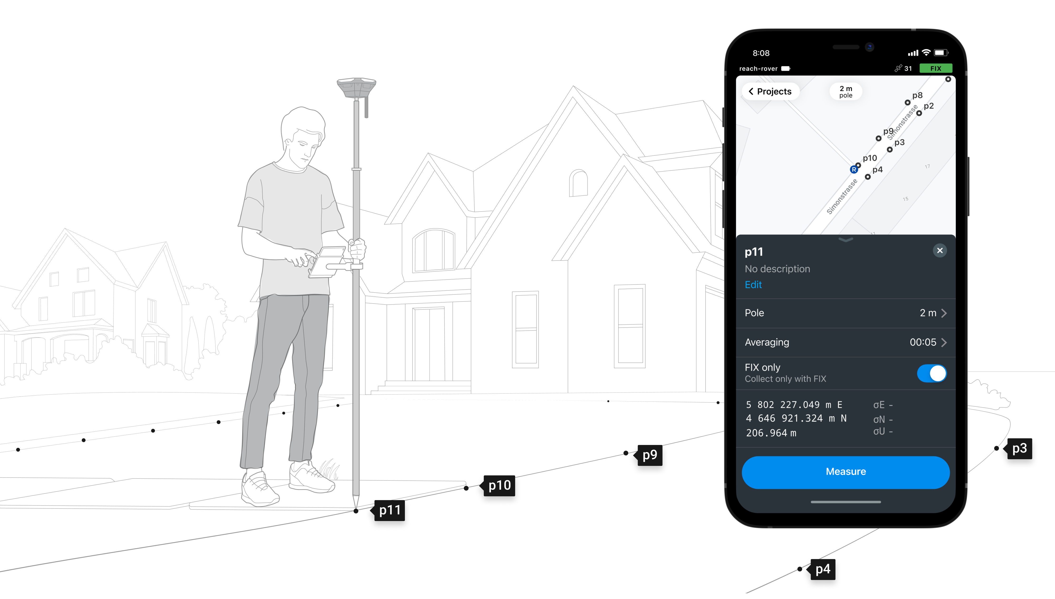

Connectivity

Real-time position
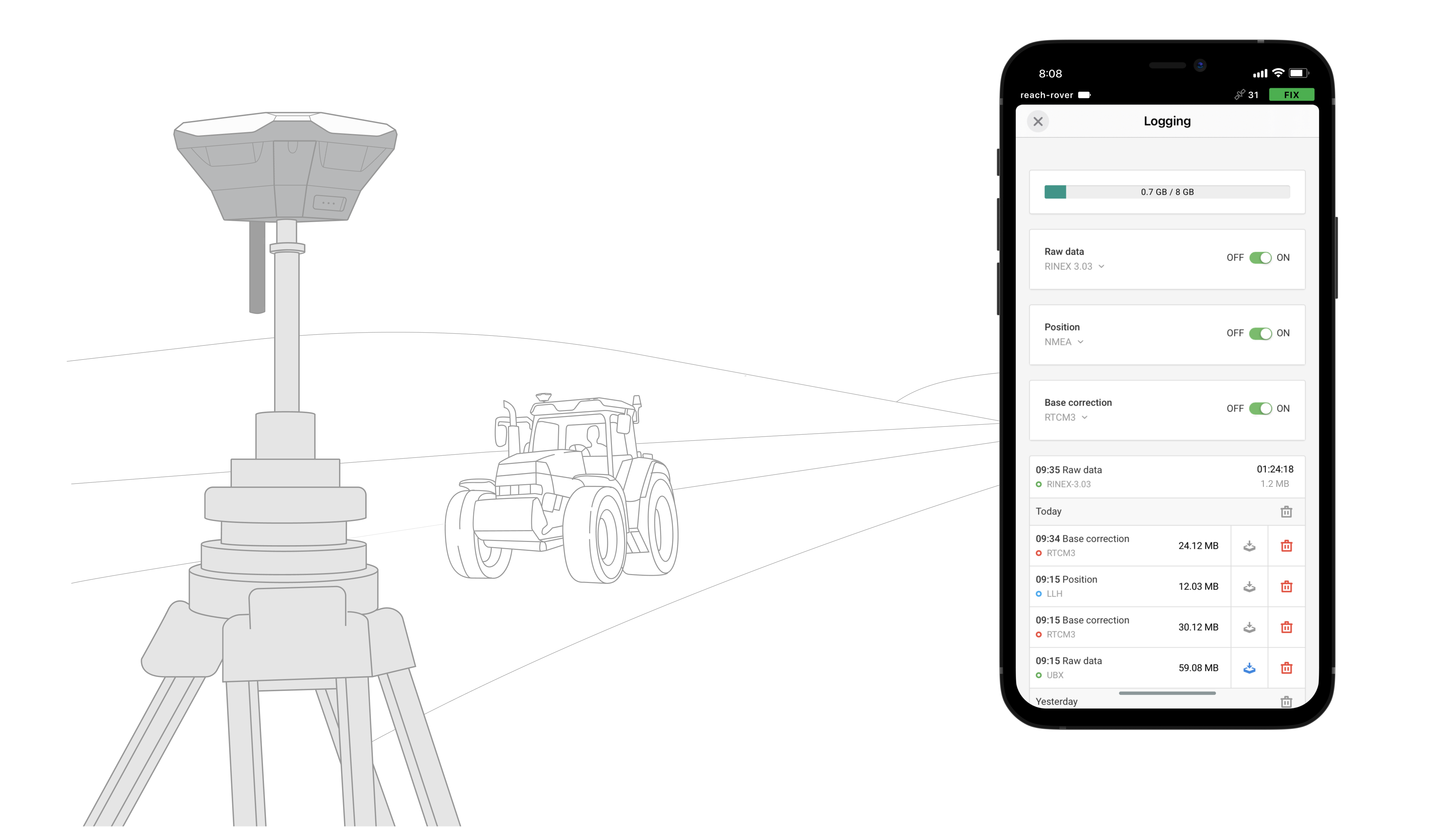
Streaming in NMEA
Reach provides data in standard NMEA that is used by most GIS apps. Simply connect your device to Reach over Bluetooth or with a cable, and turn on “Position output” in ReachView.
Reach can turn on and off automatically
Reach can turn on and off in sync with an external battery connected over RS-232. This helps when the power button is hard to reach, for example, if the receiver is placed on the roof of a tractor.
Compatible apps
MachineryGuide, AgriBus-Navi, Efarmer, Agripilot, and others
Position streaming
Interfaces
RS-232, TCP, Bluetooth

NTRIP or another Reach
as a base station
Reach RS+ needs a base station as a source of corrections. That’s a requirement for centimeter accuracy in RTK and PPK. The base might be another Reach RS+ receiver or an NTRIP service. VRS is also supported.
Reach RS+ works seamlessly with other Reach receivers over any link.
Input and output corrections
Interfaces
TCP, LoRa, Bluetooth, RS-232, NTRIP
Formats
RTCM3
Max distance from a base
Up to 10 km in RTK
20 km in PPK

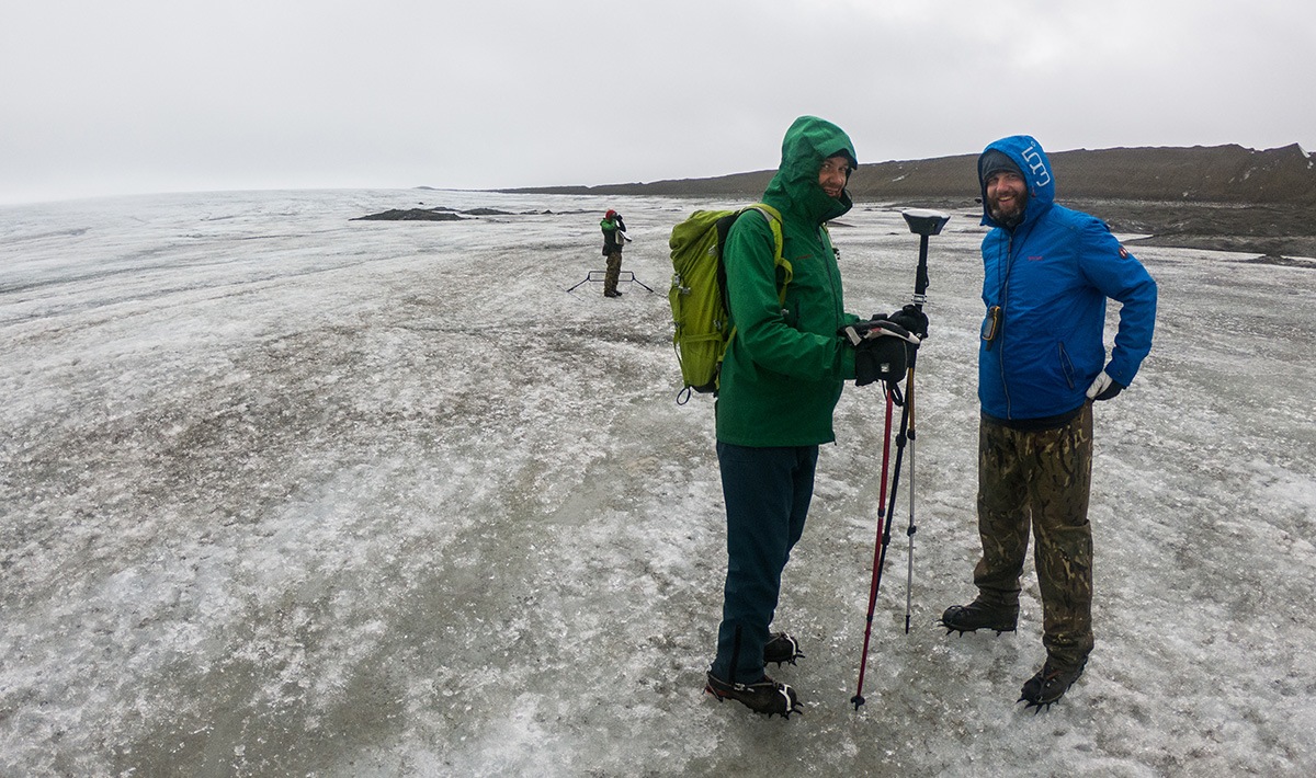
Reach RS+ is designed for harsh conditions.
Dense forests, mountains, frost, heat and water, Reach can handle it all
IP67
Can be held 1 meter deep underwater for half an hour.
-20ºС…+65ºС
Working temperature. Isn’t afraid of either heat or cold.
30 hours
Industrial LiFePO4 battery that doesn’t die when cold. Charges over USB from a powerbank.

Tutorials
Quickstart guides and a comprehensive feature overview. Step-by-step tutorials covering the most common applications. Regularly updated by our support team according to the most frequently asked questions.

Community forum
Share your project or ask any question on our community forum to get answers from experienced users and the Emlid team. Stories about using Emlid products from users all over the world.
Specifications
Mechanical
Electrical
Positioning
Connectivity
Data
GNSS

 0812-2652-2324